
Many metropolitan planning organizations are moving from traditional fixed-point planning to scenario planning for their federally mandated long-range transportation plans. But the scenarios these organizations use to build and evaluate potential plans need to be built on actual data and trends if they are going to produce good transportation plans.
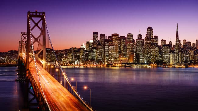
For example, Plan Bay Area 2050, the official regional long-range plan finalized by San Francisco’s Metropolitan Transportation Commission and the Association of Bay Area Governments in Oct. 2021, used a scenario-based process they called Futures Planning to examine “which strategies that could be advanced by local jurisdictions, regional agencies, or the state in the coming decades are effective under a variety of uncertain conditions?”
The first part of the process created three divergent scenarios it called “futures.” The second part analyzed and simulated how the Bay Area would likely fare under each scenario, assuming no changes to regional strategies. The third part identified strategies to address future challenges assuming changes to regional strategies. The future challenges were different in each scenario but consistent in the second and third parts.
In the first hypothetical scenario, “Rising Tides, Falling Fortunes,” the federal government reduces funding to cities and states, and international cooperation declines. In the second scenario, “Clean and Green,” an “aggressive” carbon tax is implemented, “electric vehicles become nearly universal,” and automation and telecommuting increase. In the third scenario, “Back to the Future,” the Silicon Valley economy is thriving, there is increased infrastructure investment, and a comprehensive immigration reform bill helps drive population growth in the Bay Area.
To test each of these scenarios, the Metropolitan Transportation Commission (MTC) examined a variety of external forces, including two environmental forces (like earthquakes), four economic forces (such as tax rates), five land-use forces (like shifts to telecommuting), six transportation forces (autonomous vehicles, for example), and nine political forces (like changes to trade and immigration policies). After compiling these forces, MTC created 35 strategies: one revenue strategy, six economic strategies, six environmental, nine housing, and 13 transportation strategies.
For the transportation inputs, each of the 13 strategies is rated on a scale from one to three stars, with three stars being the most effective at meeting the program’s goals and one star being the least effective. For some reason, operating and maintaining the region’s road and transit network received only one star. Meanwhile, adding new general-purpose lanes and interchanges, as well as converting high-occupance vehicle, or carpool, lanes to high-occupancy toll (HOT) lanes and adding additional HOT lanes received three stars. Adding new transit capacity, including rail lines, earned two stars. Creating a network of bus lanes received three stars. Building a new transbay rail crossing received two stars.
One problem with this approach is that MTC created an overly complex process with so many arbitrary decisions embedded in it that only people with a master’s degree in transportation planning can even begin to figure out what the plan is claiming. And even for those folks, this confusing process is a puzzle that requires a lot of effort to piece together.
A second problem with this scenario planning is the evaluation process used. Building new capacity should never receive a higher score than operating and properly maintaining useful existing assets. It’s not clear what unbiased model based on moving people and goods effectively would prioritize building new rail lines in the Bay Area when per capita ridership has been dropping for years or how that would score better and be more of a priority than maintaining highly relied upon roadways, which are also what buses use. Clearly, the scenarios are either ineffective or logically flawed.
To MTC’s credit, the agency ignored some of the results of the scenario planning and prioritized maintenance and existing operations over new projects in the long-range plan. But that did not noticeably change the exercise’s bias in favor of rail transit.
A third problem is that the 2050 plan spends 56% of all its funding on transit projects and another 4% on projects to support transit. Most of the transit funds go to new rail projects even though existing rail lines are underused. In the final plan, less expensive, more flexible bus rapid transit seems to be an afterthought, despite scoring higher than rail in the scenario planning process. Only 6% of trips in the Bay Area were made by transit in 2015, a number that is now far lower as many Silicon Valley workers and companies continue to embrace remote work after the COVID-19 pandemic. There is almost no new roadway capacity in the final version of the plan, even in parts of the Bay Area suffering from significant traffic congestion, despite more road capacity enhancements receiving three stars in the exercise.
A fourth problem is, despite federal law requiring it to be primarily a transportation plan, only six of the 26 criteria used to select plan projects are related to transportation. Compare that to the nine related to political dynamics. There is no escaping politics and things like trade policy certainly impact infrastructure needs, but guessing about nine unknowable and arbitrary political forces is too high a number to significantly influence a 30-year regional transportation plan.
How do cities and regions learn from the Bay Area to avoid or fix these problems? First, urban planners need to come up with realistic scenarios. One could favor realistic technology such as electric vehicles, one could forecast slow population or economic growth, and one could favor something resembling the status quo.
However, for a long-range transportation plan to be useful, it has to be realistic based on the best data and trends we have access to now. The status quo scenario cannot resemble an apocalyptic wasteland from a movie, nor should the technology scenario predict everyone getting to work on shared hoverboards. In Silicon Valley computer firms, the saying used to be garbage in, garbage out. Put in bad data, and you’ll get nonsense from it. Transportation planners could run the Bay Area scenarios and models it chose dozens of times and still not get credible data to create an effective, viable long-range mobility plan for the region.
Planners need to be sensitive to real-world conditions and budget constraints. It does not make sense to spend so much money on new rail capital projects when rail ridership is declining and showing no sign of returning amidst telecommuting and technological trends. Similarly, he amount of money devoted to maintenance in Plan Bay Area 2050 cannot bring highways and transit to a state of good repair. California’s highway system is perennially in the bottom 10 nationwide, largely because the roadway pavement is in terrible condition.
Rather than creating dream scenarios and the transportation systems planners would like to build from scratch, scenario planning is only effective if planners utilize realistic user and budget scenarios with solid data and extrapolation techniques that create realistic models designed to best serve the people who will actually be using the transportation system in the next few decades.